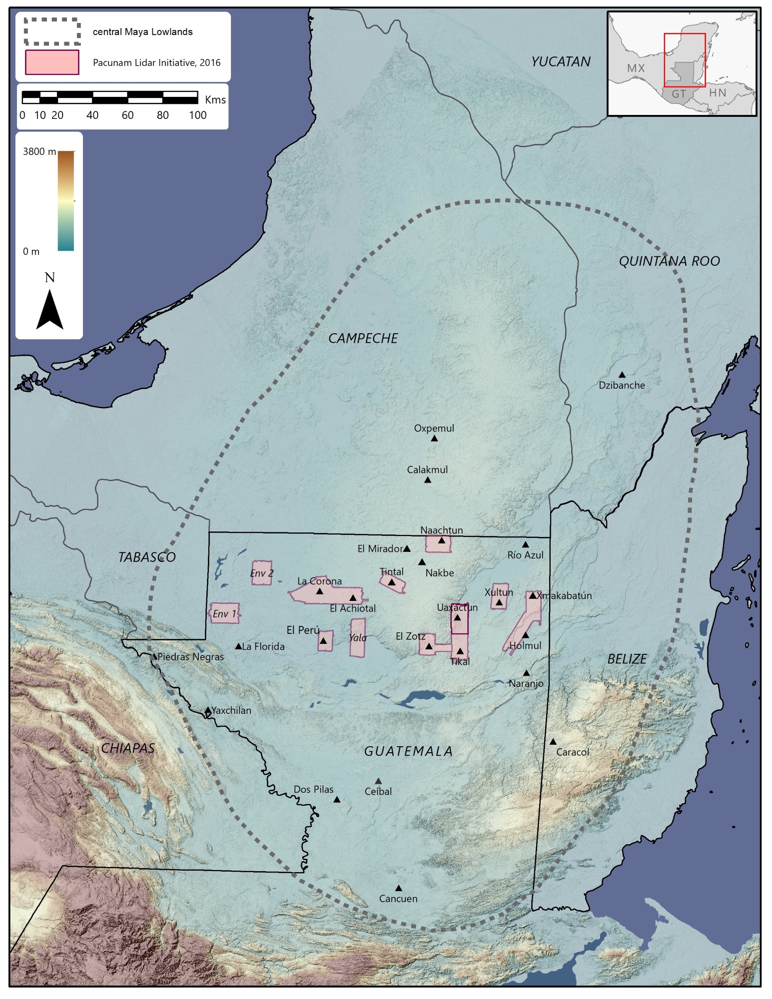
Archaeology may not be the most likely place to find the latest in technology — AI and robots are of dubious utility in the painstaking fieldwork involved — but lidar has proven transformative. The latest accomplishment using laser-based imaging maps thousands of square kilometers of an ancient Mayan city once millions strong, but the researchers make it clear that there’s no technological substitute for experience and a good eye.
The Pacunam Lidar Initiative began two years ago, bringing together a group of scholars and local authorities to undertake the largest-yet survey of a protected and long-studied region in Guatemala. Some 2,144 square kilometers of the Maya Biosphere Reserve in Petén were scanned, inclusive of and around areas known to be settled, developed or otherwise of importance.
Preliminary imagery and data illustrating the success of the project were announced earlier this year, but the researchers have now performed their actual analyses on the data, and the resulting paper summarizing their wide-ranging results has been published in the journal Science.
The areas covered by the initiative, as you can see, spread over perhaps a fifth of the country.
“We’ve never been able to see an ancient landscape at this scale all at once. We’ve …read more
Source:: TechCrunch Gadgets

 Previous post